
By Oisin O’Brien
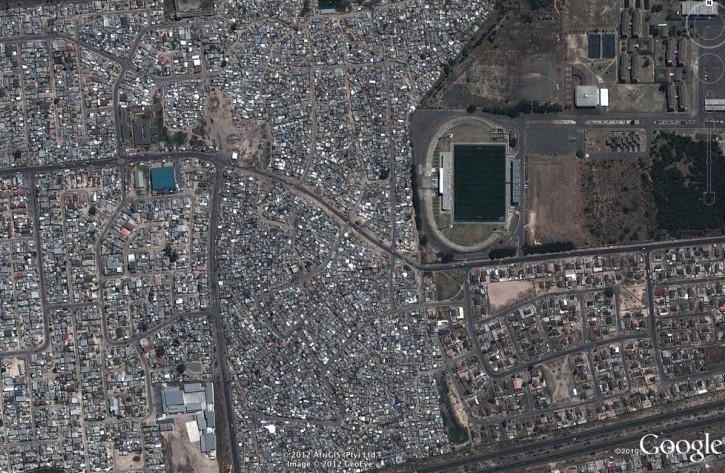
The Cape Flats is a region of metropolitan Cape Town located to the south and east of the city center. A conglomerate of suburban townships and slums, it spans an area of approximately 500 square kilometers over flat, low-lying terrain. In 1952, apartheid mandated that black and coloured persons live separately from whites, the townships that comprise Cape Flats were created to house the displaced populations apartheid created. Initially, housing stock was built by the government, but they were not able to meet demand and informal housing quickly sprung up. The population of the Cape Flats is difficult to determine because it comprises so many smaller entities, however, two of the major townships of the Cape Flats, Mitchell’s Plain and Khayelitsha, have populations of 305,430 and 400,000 respectively. The population of the Cape Town metropolitan area is 3.5 million, indicating that the Cape Flats accounts for a substantial portion of the city’s population (City of Cape Town Information and Knowledge Department, 2005; Curry, 2011). Population density for the Flats ranges from 3,520 per square kilometer in some pockets to 46,520 per square kilometer (Strategic Development Information, 2006). Cape Town’s Information and Knowledge Management Department (2005) provide the following metrics: In Mitchell’s Plain, unemployment is 30 percent; in Khayelitsha, it is 51 percent. Mitchell’s Plain has a significantly lower percentage of workers employed in unskilled occupations compared to Khayelitsha (19.8 percent versus 44.1 percent), and a much higher percentage of workers engaged is manufacturing (26 percent versus 10 percent). In Mitchell’s plain, 6 percent of the population live in shacks in informal settlements, and 3.5 percent in backyard shacks, while in Khayelitsha the figures are 57.4 percent and 7.3 percent respectively. In Mitchell’s Plain, 94 percent of households have access to electricity, but in Khayelitsha only 76 percent do. Similar disparities exist in sanitation, with 5.7 percent of residents in Mitchell’s Plain having no access to formal sanitation to Khayelitsha’s 26 percent.
The lack of access to electricity for many in Mitchell’s Plain and Khayelitsha forces residents to rely on paraffin for cooking and illumination. The discrepancy between Khayelitsha’s electricity access (76 percent) and its population in informal settlements (65 percent) indicate that there is a significant amount of informal access to the grid, increasing the risk for fires and electrocution. Informal electrical access and reliance on paraffin necessitate residents be more frugal with their resources. Using the toilet can be a demeaning experience for those without proper access, requiring for some a five-minute walk and bargaining with neighbors who control access to public toilets within their jurisdiction (Smith, 2005).
The crucial first step towards improving infrastructure in the informal settlements of Cape Flats is to end the policy of solving the problem of informal settlements by demolishing them. This authoritarian intervention does damage as it increases the instability of the slum-dwellers without providing a viable alternative to their housing. By granting land tenure and formalizing the settlement, the government will signal its willingness to improve conditions inside the informal settlements. Instituting a program for expanding the electrical network to increase access and employing labor from the informal settlements would have social and economic benefits.
This article is a product of Professor Shagun Mehrotra’s Global Urban Environmental Policy class. Views expressed are entirely those of the individual author.
References
Cape Town Information and Knowledge Management Department. (2005). A Population Profile of Mitchell’s Plain: Economic information from the 2001 Census. Cape Town. Accessed on February 4th 2012 http://www.capetown.gov.za/en/stats/CityReports/Pages/default.aspx
Cape Town Information and Knowledge Management Department. (2005). A Population Profile of Khayelitsha: Economic information from the 2001 Census. Cape Town. Accessed on February 4th 2012 http://www.capetown.gov.za/en/stats/CityReports/Pages/default.aspx
Cape Town Strategic Development Information and GIS. (2006) 2001 Population Density per km2 by Suburb. Accessed on February 4th 2012. http://www.capetown.gov.za/en/stats/Documents/Area.htm
Curry, E. (2011, January 28). New, Assertive Women’s Voices in Local Elections. Inter Press Service. Accessed February 4 2012 http://ipsnews.net/news.asp?idnews=54270
Google. (2012). Google Earth (Version 6.0.3.2197) [Software]. Available from http://www.earth.google.com
Smith, A. (2005, July 18). Atrocious QQ section stuns community. Independent Online. Accessed on February 4th 2012 http://www.iol.co.za/news/south-africa/atrocious-qq-section-stuns-community-1.248472